


")
Gallery
URPoint Details
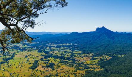
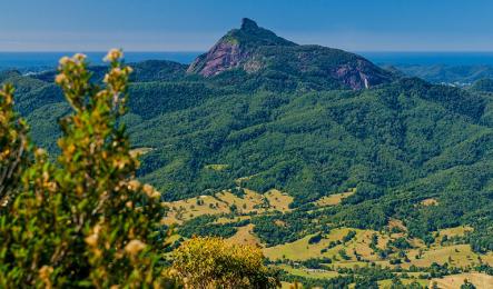
Mt Warning (Wollumbin)
Mount Warning was first named such by Captain James Cook on his East Coast voyage along the (then-declared) New South Wales British territory in 1770.
It was named Mount Warning by Captain Cook to warn future mariners of the offshore reefs he encountered in May 1770. Mt Warning is lcoated in Northern NSW within the Mt Warning National Park.
It is also known as 'Wollumbin' meaning 'cloud catcher', by the Bundjalung people who lived in the region for thousands of years before European settlement.
Geologists believe Mt Warning last erupted 23 million years ago and was active for three million years. It is a volcanic plug that formed alongside the major volcano if the region, the Tweed volcano, that formed the caldera region now known as the Scenic Rim.
Official height 1156metres (3,793 ft). Summit elevation 1125m.
Breathtaking scenery
The Scenic Rim region is named becasue it is rimmed by an imposing volcanic mountain range, dating back millions of years.
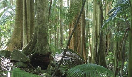
The legacy of this volcanic past is Australia’s most accessible World Heritage-listed rainforests and rich alluvial soil and remains the lifeblood of the region.
Tourism and agriculture are the Scenic Rim’s two leading industries.
The Scenic Rim is home to six National Parks and is a haven for bushwalkers, naturalists, birdwatchers and lovers of spectacular views.
The region is also a food bowl for Queensland and markets further afield. During winter the alluvial valleys produce vegetables for markets up and down the Australian east coast. The Scenic Rim is also home to beef, pork and poultry producers and boasts growing boutique and gourmet food, wine and craft beer industries.
Geo history
It’s not until you investigate how the Scenic Rim came to be that you realise how significant this dense cluster of mountains is. The Scenic Rim Mountains and the Mt Warning area in northern NSW are known as the Green Cauldron and were once a volcanic hotspot, which over the years has grown into a lush landscape featuring six National Parks.
Scenic Rim geologist, Dr John Jackson, says the Scenic Rim was formed over a three million year period, more than 26 million years ago.
“As the heat intensified, volcanic activity erupted and the mountains formed from magmas and lavas that intruded from the hotspot,” Dr Jackson explains.
Mt Warning and Focal Point Mountains are known volcanoes and John says there were most probably others, but proving it is difficult.
“Australia was travelling north over a hotspot, then it changed direction and slowed down and that is the real reason for the Scenic Rim. The change in direction and the slower speed allowed for the build up of the dense mountain range. To give you an idea of the speeds, when Peak Crossing to the Glass House Mountains was formed we were travelling about 70km/million years. That speed slowed to 26km/million years when the Scenic Rim was created and you get the effect of the mountains that are all stacked up together.
“By the time we reached Mt Warning, Australia speeds up again and the mountains are more dispersed.”
Source: Scenic Rim Regional Council.
- Type:
- Landmark